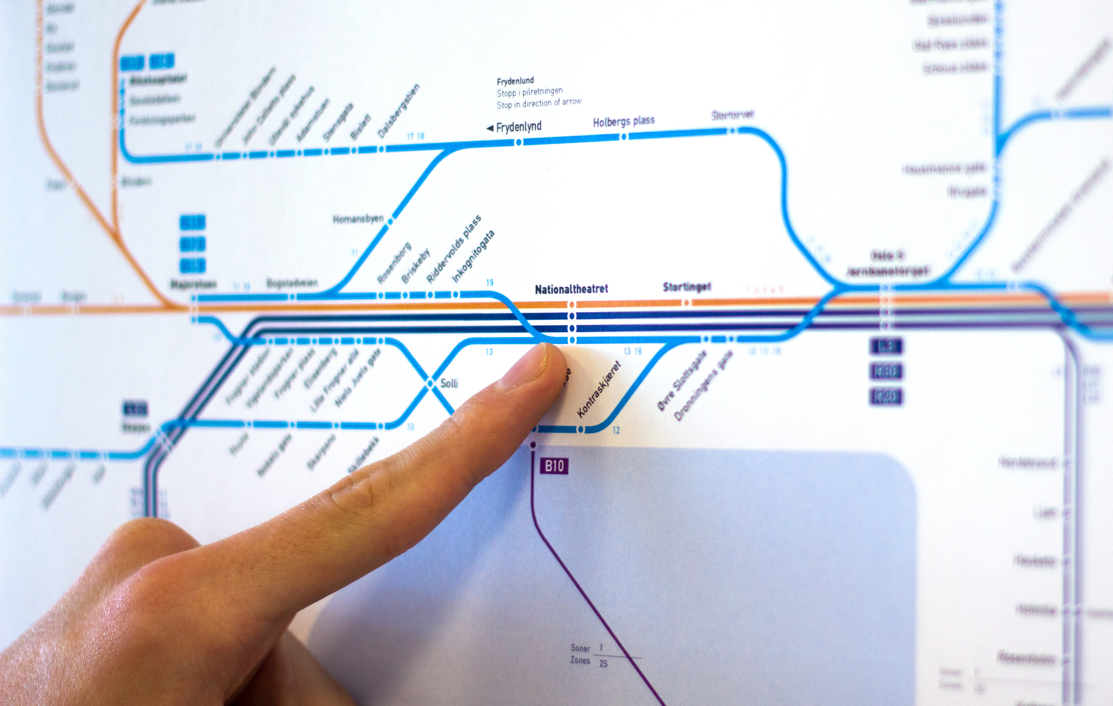
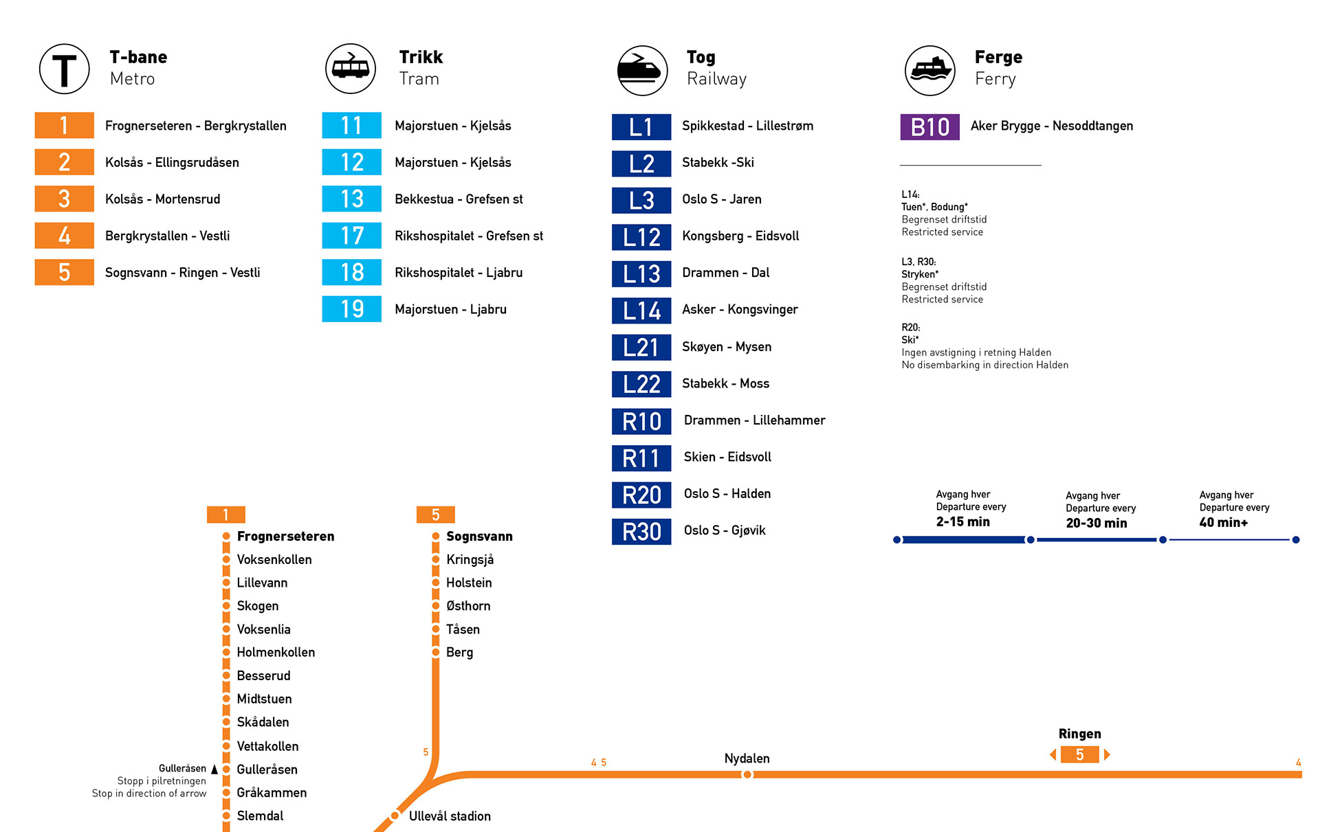
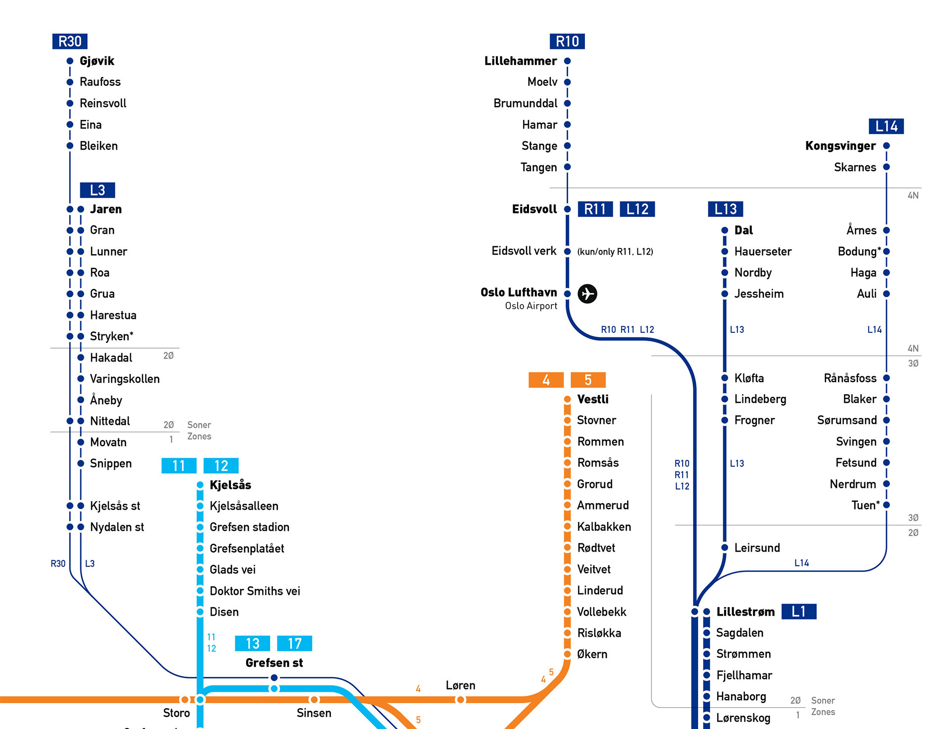
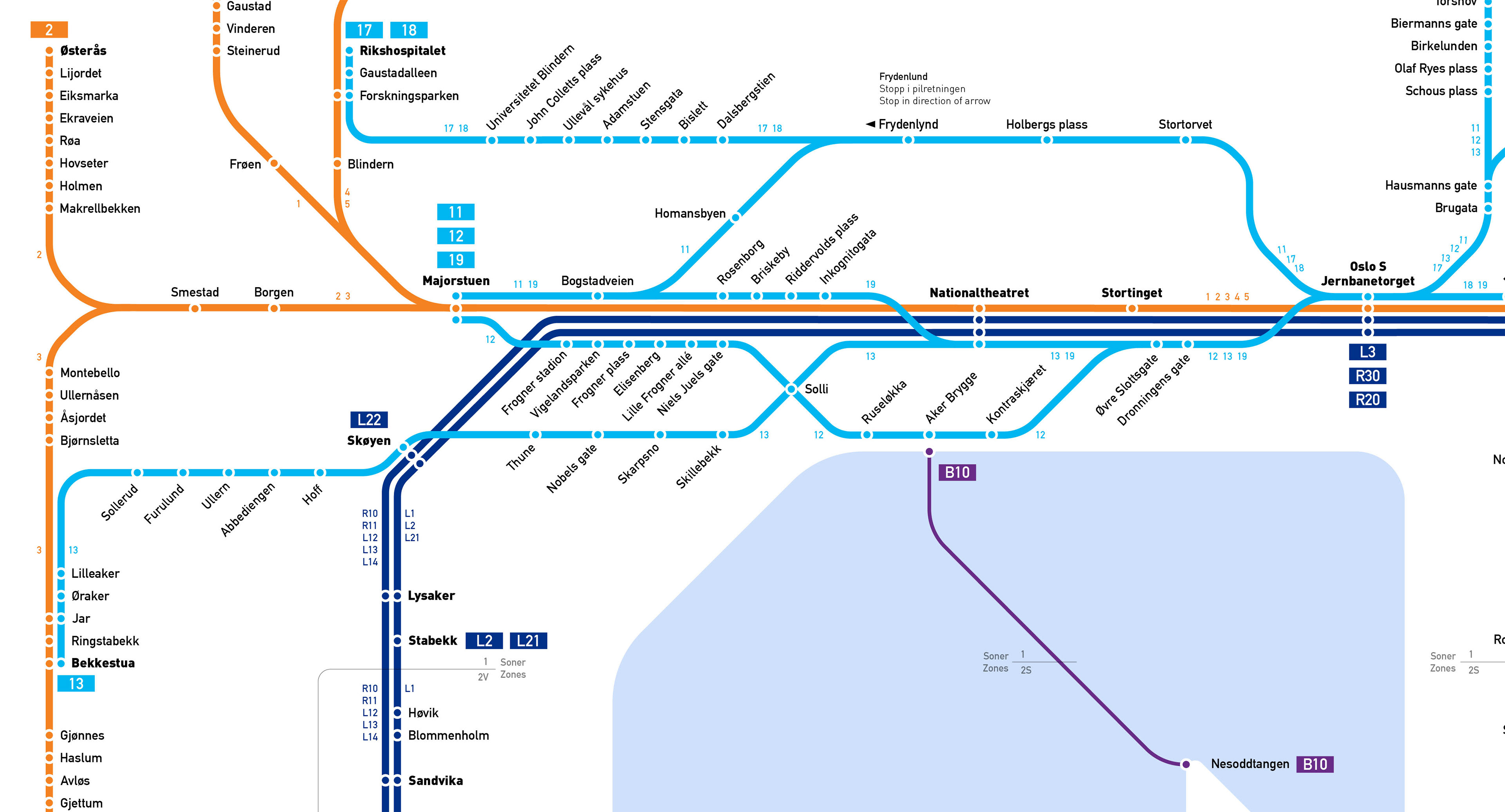
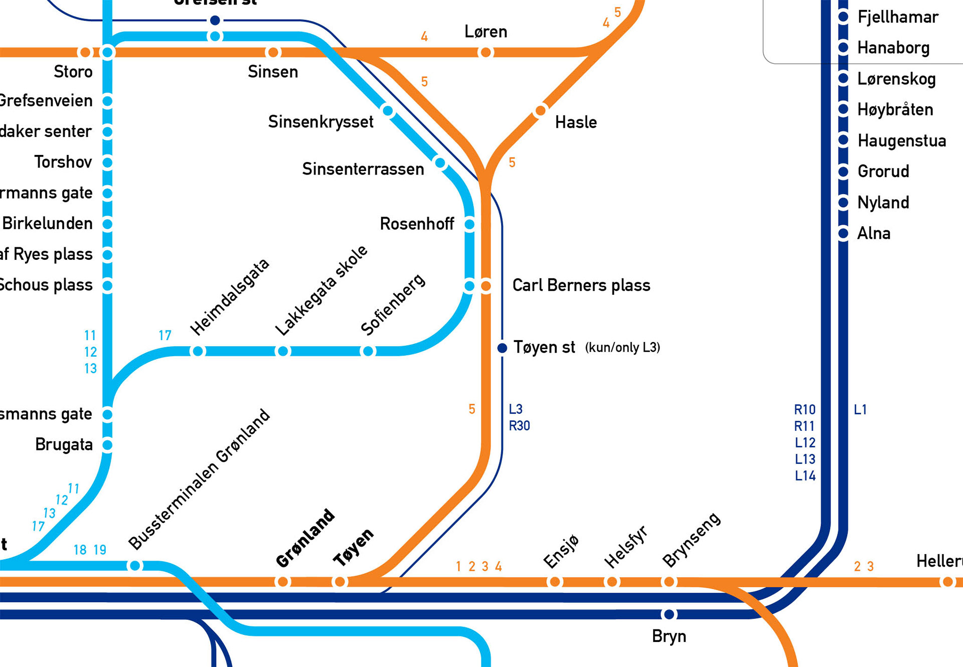
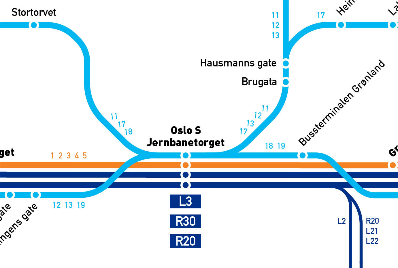
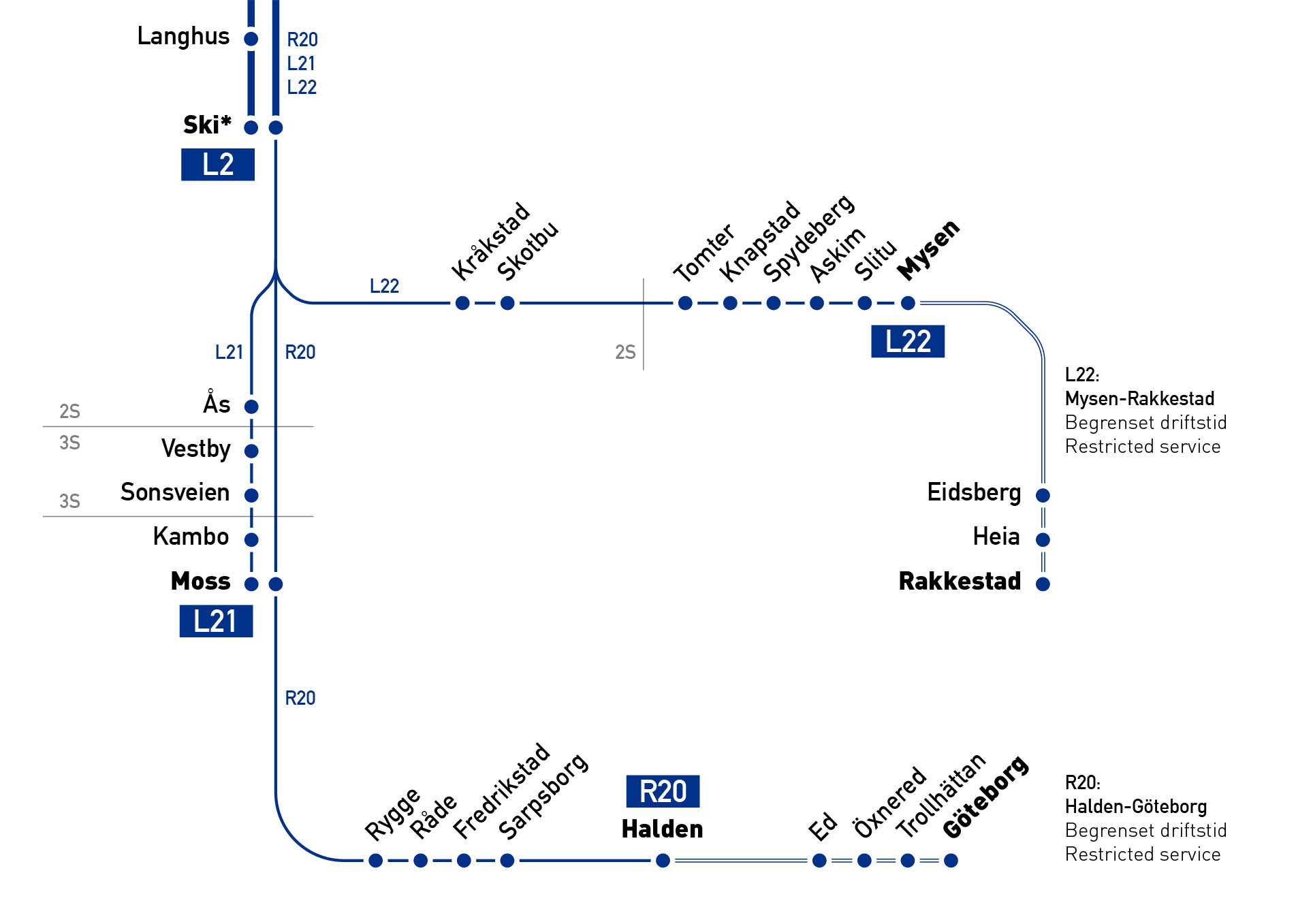
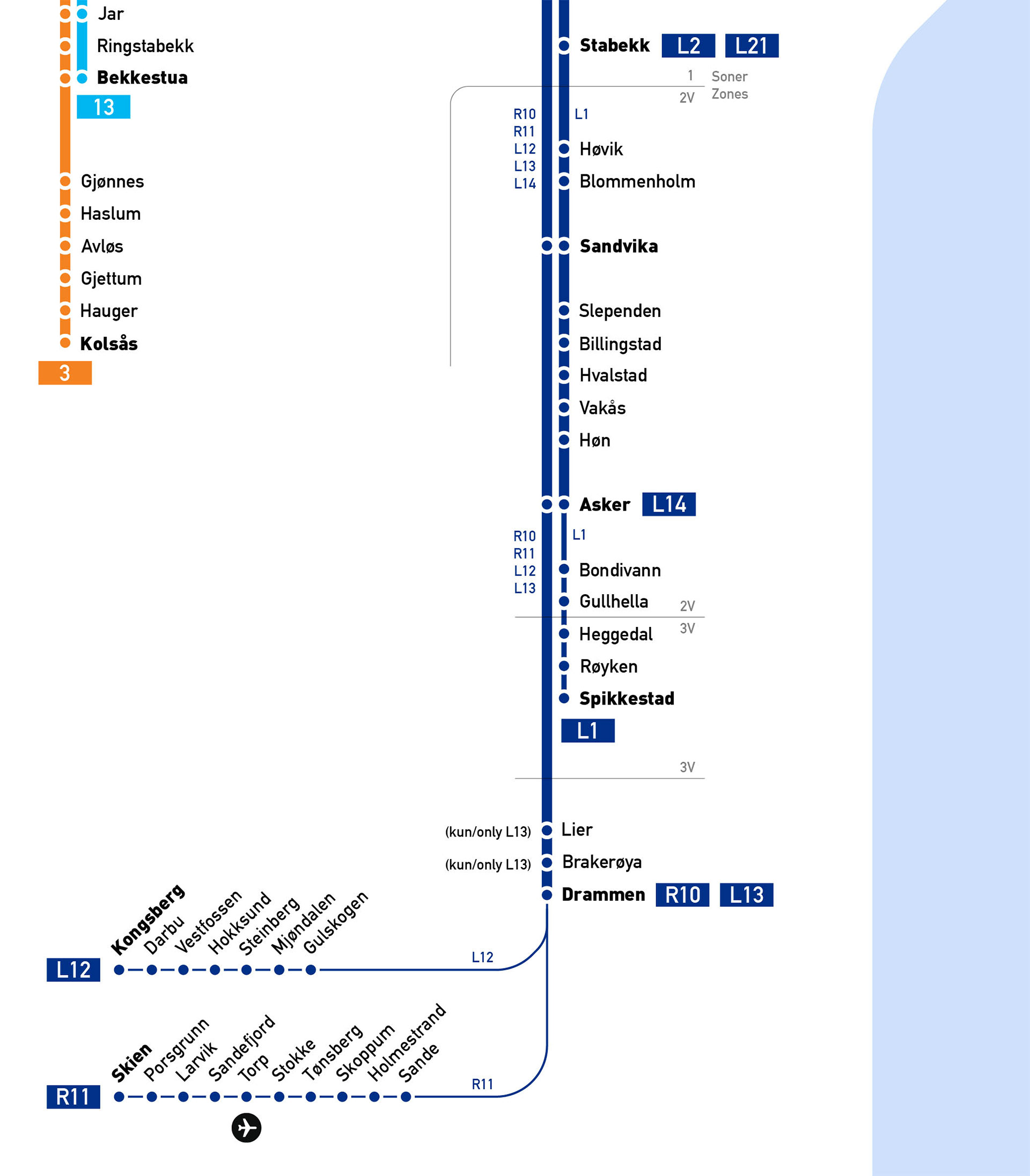
This is an unofficial public transportation map covering Oslo and the surrounding metropolitan area. The map features metro, tram, railway and ferry lines.
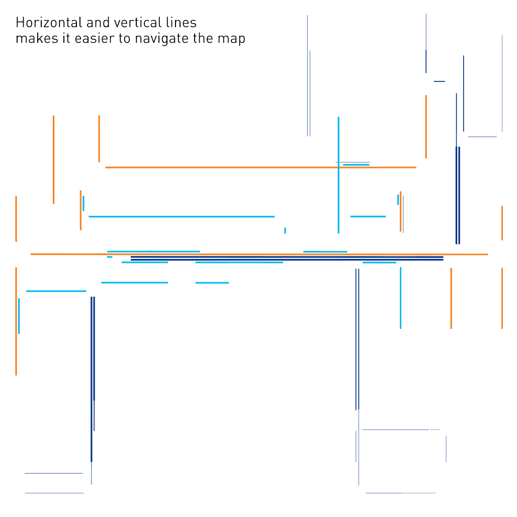
It's designed with user experience in mind, making it simple and easy to navigate around. This is achieved by using as many horizontal and vertical lines as possible, as well as minimising the amount of cluster. The map provides attention to metro and tram lines in the city centre, while still giving space for intercity railway lines.
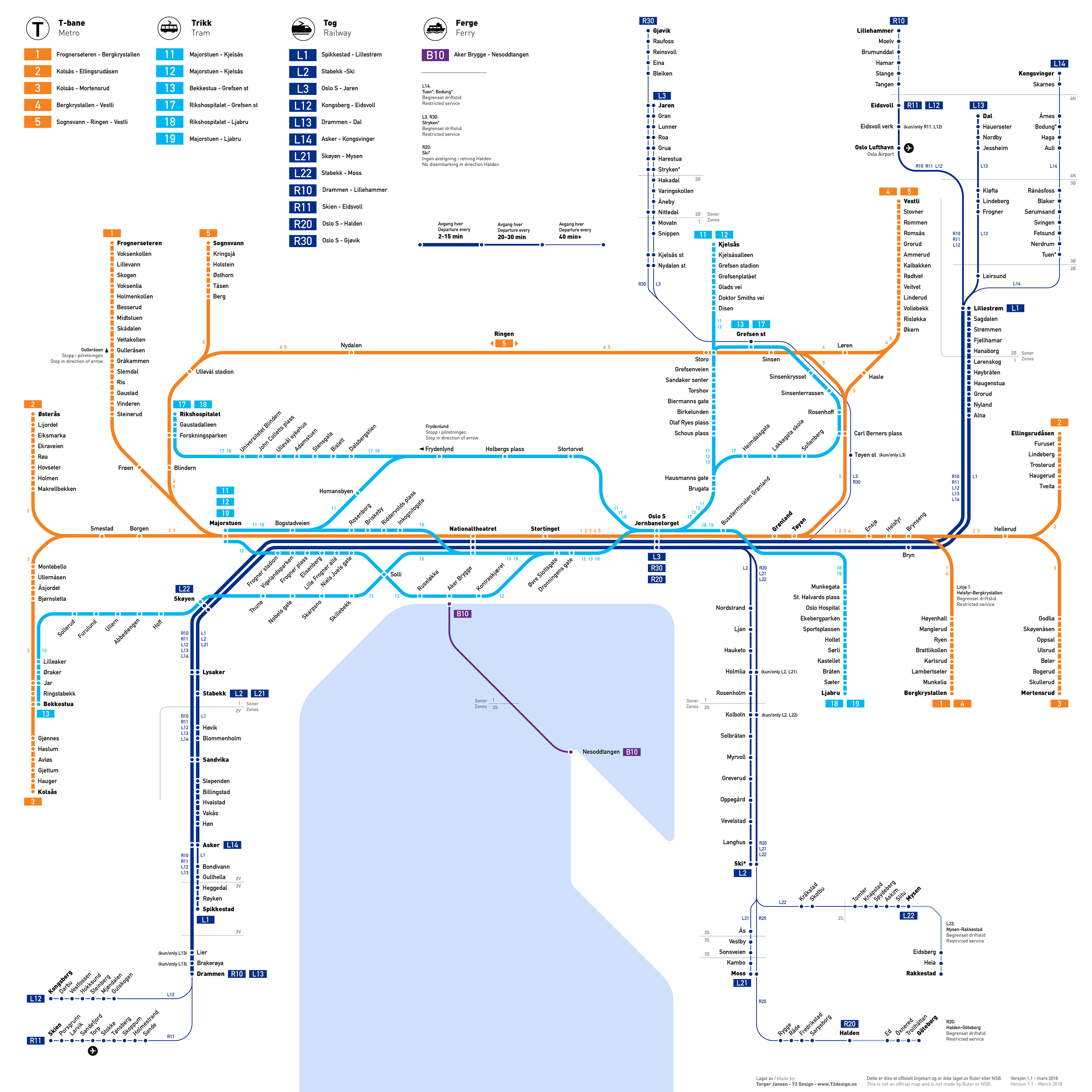
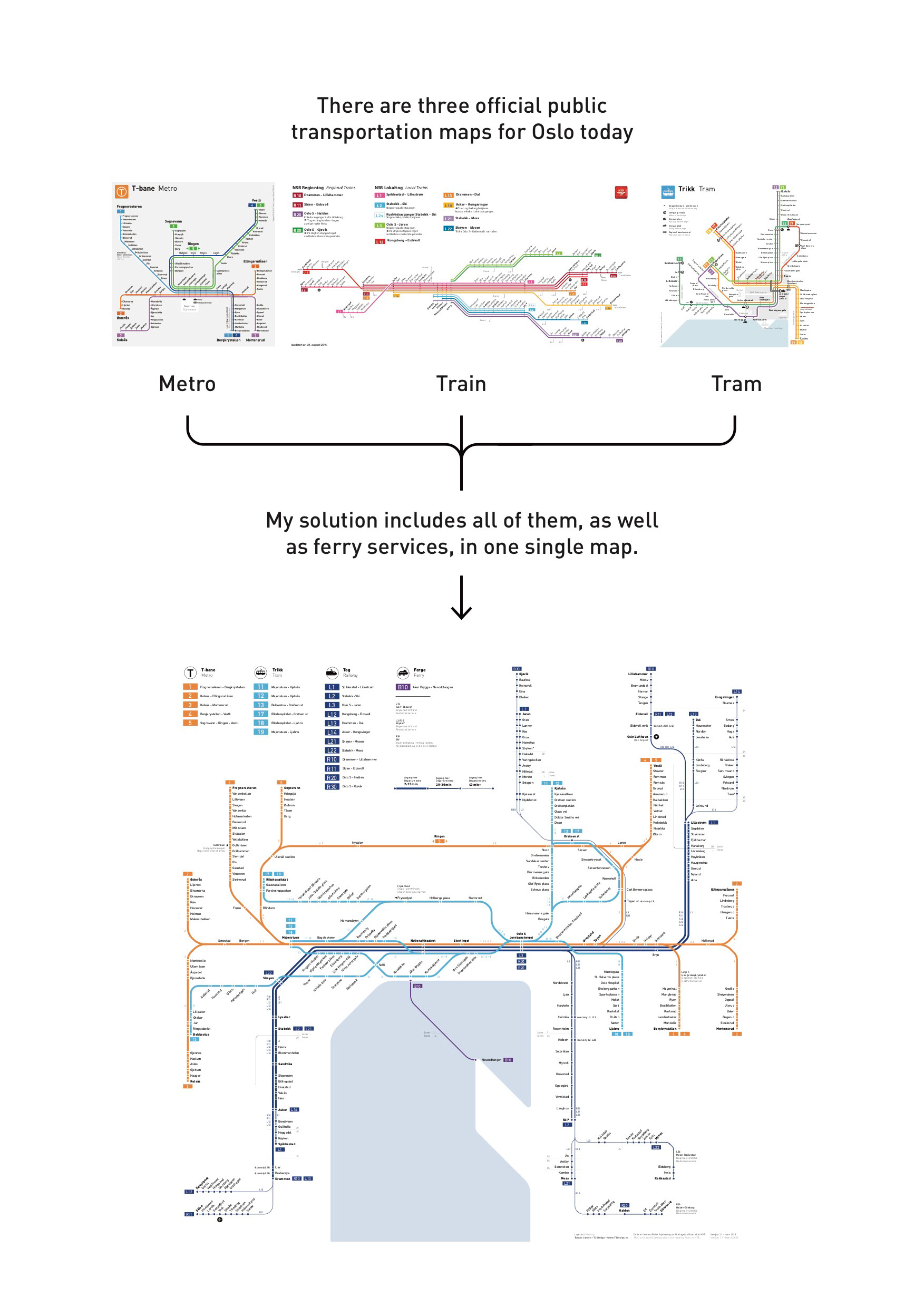
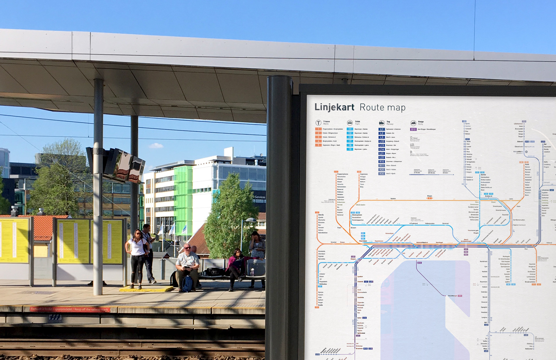
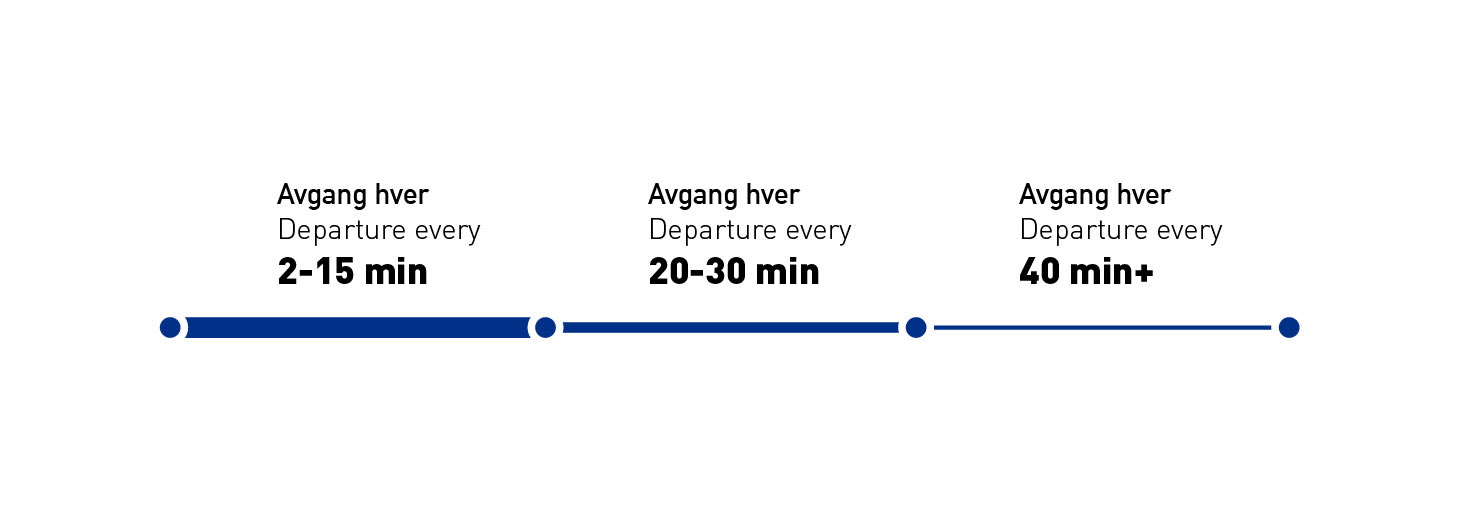
Ever wondered how frequent train services are by looking at a map? With three different line weights, you can now have a much better overview and plan your journey like a pro.
The map was last updated March 2018.